
Land surveying has come a long way from the days of compasses and measuring tapes! With modern technology, surveyors now have access to tools that make their work faster, safer, and more accurate than ever.
From drones soaring high above to 3D scanning and AI-powered software, technology has completely reshaped the surveying landscape, especially in bustling urban areas like Dhaka.
This article dives into the latest technology in land surveying, looking at how they work, why they’re used, and the practical impact they’re having.
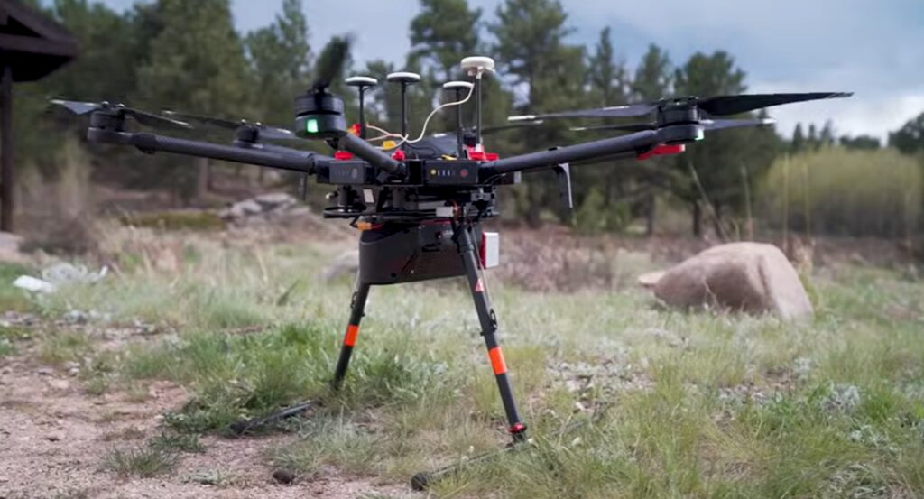
#1. Drones and UAVs (Unmanned Aerial Vehicles)
Drones are one of the most exciting tools to join the surveying toolkit. With the ability to fly over any terrain, drones capture detailed aerial images, collecting data much faster than traditional methods. These images can then be stitched together to create highly accurate maps and 3D models.
In Dhaka, where access to certain areas can be tricky due to dense development or environmental factors, drones offer a practical solution. They help surveyors reach locations that would otherwise require complex setups and equipment.
Drones are particularly useful for large sites, allowing surveyors to gather extensive information from the air without stepping foot on every square metre.
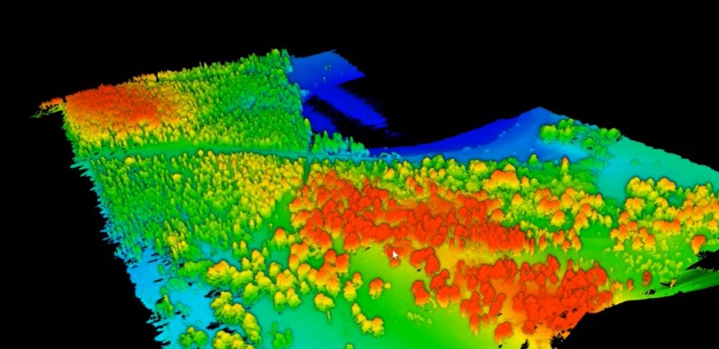
#2. 3D Laser Scanning (LiDAR)
LiDAR (Light Detection and Ranging) is another revolutionary tool that makes surveying faster and more detailed. By using laser pulses to measure distances, LiDAR systems create a precise 3D map of the surrounding environment. This technology is excellent for capturing complex terrains, urban landscapes, and even vegetation layers with a high degree of detail.
In Dhaka, where land is often densely packed and changes frequently, LiDAR helps city planners and construction companies map out projects with impressive accuracy.
Whether it’s for infrastructure development, environmental monitoring, or roadwork, 3D laser scanning gives surveyors the kind of data that was once unthinkable.
#3. Global Navigation Satellite System (GNSS)
We’re all familiar with GPS in our smartphones, but GNSS (Global Navigation Satellite System) takes things to the next level for surveying. GNSS uses multiple satellite networks, which, combined with real-time kinematic (RTK) corrections, allows surveyors to pinpoint exact locations with centimetre-level accuracy.
This technology is particularly useful in urban areas like Dhaka, where positioning precision is crucial. GNSS is versatile and able to perform well in open areas and semi-urban zones alike, making it a go-to tool for surveyors mapping out new developments or gathering data for infrastructure projects.
4. Robotic Total Stations
Imagine having a “smart assistant” on-site, helping you measure distances and angles while minimising human error. Robotic Total Stations are just that. These automated systems can track survey prisms, calculate angles and distances, and capture data without constant human adjustment. The result? Surveying becomes a quicker, more accurate process.
For large-scale projects in Dhaka, robotic total stations are invaluable, speeding up workflows and reducing the need for a team of surveyors to be physically present at every point. This not only saves time but also ensures that measurements are consistent and accurate across the entire project.
#5. Augmented Reality (AR) and Virtual Reality (VR) in Surveying
AR and VR might seem more at home in video games than land surveying, but these technologies are becoming essential for project planning and visualisation. Augmented Reality can overlay digital models onto real-world settings, allowing surveyors and stakeholders to visualise a project before it’s built.
VR, on the other hand, creates a fully immersive experience, ideal for pre-construction walkthroughs.
In Dhaka, AR and VR technologies help surveyors and clients visualise and plan projects with a clearer perspective. It’s especially helpful in crowded urban areas where space is limited, giving teams a realistic preview of how a new structure will fit within the existing landscape.
#6. Geographic Information Systems (GIS) and Cloud Data Processing
Geographic Information Systems (GIS) have long been a staple for surveyors, but today’s GIS platforms are more powerful than ever. GIS software is essential for storing, processing, and analysing spatial data, while cloud-based processing enables teams to access and work with data from anywhere without being tied to a physical office.
For surveyors in Dhaka, this means faster collaboration and smoother project management. Large projects with multiple stakeholders can benefit greatly from the ability to access and edit data on the go, streamlining workflows and reducing miscommunication.
#7. The Role of AI and Machine Learning
Artificial Intelligence (AI) and Machine Learning are the quiet heroes of the surveying world. AI algorithms can process vast amounts of data, identify patterns, and even predict outcomes based on historical data.
Machine learning models are now used to automate routine tasks, sort data, and make real-time adjustments to measurements.
In Dhaka, where surveyors often handle complex data sets, AI and machine learning make their work easier and more reliable. By reducing the need for manual data sorting, these tools help surveyors focus on critical analysis and interpretation, improving both the speed and quality of their output.
#8. The Future of Surveying Technology
The world of land surveying is only getting more tech-savvy, and as cities like Dhaka continue to expand, the demand for accurate and efficient surveying solutions will only grow.
We can expect to see even more automation, real-time data processing, and maybe even new uses for technologies like blockchain to secure land records. As these tools evolve, they’ll keep reshaping the field, making surveying faster, more precise, and more accessible than ever.
Conclusion
Technology has taken land surveying to new heights, transforming the industry from slow, manual methods to a high-speed, high-tech field. In Dhaka, where urban planning and infrastructure are in full swing, these technologies provide the accuracy and speed essential for keeping up with the city’s demands.
From drones to AI-powered software, the latest tools are making it easier for land surveyors in Dhaka to tackle Dhaka’s unique challenges. As these technologies advance, the future of land surveying in Dhaka looks incredibly promising, with even more innovations on the horizon!