
Land Surveyor in Dhaka Bangladesh
Geo Static Survey Engineering & Consultants: Your Trusted Partner for Accurate Land Surveying in Bangladesh.
Top Land Surveying Services in Bangladesh
Looking for the best land surveyor in Bangladesh? GEO Static Survey Engineering and Consultants could be the suitable option for you. As the most trustworthy survey company in Bangladesh, we provide top-notch services tailored to your needs.
Our expert team specializes in a wide range of surveying services, including:
- Land Surveying
- Digital Land Surveys
- Topographic Surveys
- Engineering Surveys
- As-Built Surveys
- Contour Surveys/Spot Level Surveys
- Demarcation and Boundary Surveys
- Construction Site Surveys
- 3D Laser Scanning
- Drone Surveys (UAV)
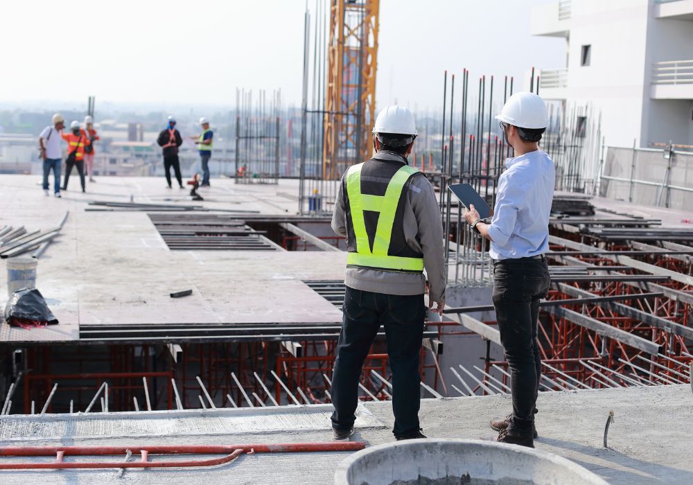
Whether you’re involved in construction, real estate, urban planning, or infrastructure development, Geo Static Survey Engineering & Consultants delivers reliable results that form the foundation of successful projects.
Our professional surveyors combine cutting-edge technology with years of local experience to ensure your survey needs are met with the highest standards of accuracy and efficiency.


Why Choose Us for Your Land Surveying Projects in Bangladesh?

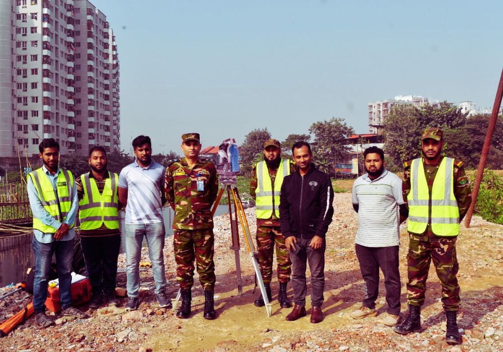
Experienced team in Bangladesh: GEO Static land surveyors have more than 16 years of experience in numerous projects across Dhaka, Chittagong, Khulna, Rajshahi, Sylhet, Barisal, and all over Bangladesh. This extensive experience ensures we can handle any terrain or project type with precision.
Combination of expertise in the field: Our team combines theoretical knowledge with practical experience, allowing us to tackle complex surveying challenges efficiently and effectively.
Use of latest surveying technology and instruments: We invest in cutting-edge surveying equipment to ensure the highest accuracy in our measurements and data collection. From total stations to 3D laser scanners and drones, we use advanced technology to deliver unparalleled precision in our surveys.
Trusted by clients: Our long list of repeat clients and positive testimonials speak to the quality and reliability of our services.
Timely project completion to meet your deadlines: We understand the importance of time in project management and strive to deliver results within agreed timelines.
Clear, detailed reports: Our reports are comprehensive yet easy to interpret, ensuring you can make informed decisions based on our findings.
Comprehensive surveying services: From land surveys to engineering surveys and beyond, we offer a full spectrum of surveying services to meet all your project needs.
Delivering high-quality, accurate results: Quality and accuracy are at the core of our work ethic. We don’t compromise on the standards of our deliverables.
Don’t leave your property’s future to chance. Trust the most dependable name in Bangladesh land surveying. Contact GEO Static Survey Engineering and Consultants today and experience the difference that true professionalism makes in land surveying and beyond.
Ready to start your project with confidence? Reach out to GEO Static – where precision meets reliability in surveying services across Bangladesh.
Looking for an expert land surveyor to discuss your upcoming projects?
What to Look for When Hiring a Land Surveyor in Bangladesh
Qualifications and Accreditations
First and foremost, verify the surveyor’s qualifications. In Bangladesh, look for professionals accredited by the Institution of Engineers, Bangladesh (IEB) or the Bangladesh Professional Engineers Registration Board (BPERB). These organisations ensure that surveyors meet rigorous standards of practice.
Breadth of Services
The ideal surveyor should offer a comprehensive suite of services. From traditional land surveys to modern techniques like LiDAR scanning, ensure your chosen company can handle various surveying needs. This versatility is particularly crucial in Bangladesh’s diverse landscape, from the urban sprawl of Dhaka to the coastal regions of Chittagong.
Technological Prowess
In today’s digital age, cutting-edge technology is non-negotiable. Enquire about the company’s equipment arsenal. Do they use the latest GPS systems? Are they proficient with drone technology for aerial surveys? In Bangladesh’s often challenging terrain, from the Sundarbans to the Chittagong Hill Tracts, advanced tech can make all the difference.
Local Knowledge
Bangladesh’s unique geography presents specific challenges. A surveyor with extensive local experience will navigate these complexities more effectively. Ask about their familiarity with Bangladesh’s land laws, which can be intricate and vary by region.
Client Testimonials
Word of mouth is powerful. Seek recommendations from colleagues or review online testimonials. In Bangladesh’s close-knit business community, a surveyor’s reputation can speak volumes about their reliability and quality of work.
Transparency in Pricing
Discuss costs upfront. While price shouldn’t be the sole deciding factor, a reputable surveyor will provide clear, itemised quotes. Be wary of those offering rates significantly lower than the market average in Bangladesh.
Communication Skills
Effective communication is crucial. Your surveyor should be able to explain complex technical concepts in layman’s terms. This skill is particularly important in Bangladesh, where projects often involve multiple stakeholders with varying levels of technical knowledge.
Timely Delivery
In Bangladesh’s fast-paced development sector, time is often of the essence. Discuss project timelines and ensure the surveyor can meet your deadlines without compromising on quality.
Environmental Awareness
Given Bangladesh’s vulnerability to climate change, choose a surveyor who demonstrates awareness of environmental issues. They should be able to advise on sustainable development practices relevant to your project.
Post-Survey Support
The relationship shouldn’t end with the delivery of survey results. Opt for a company that offers post-survey consultations and is willing to clarify any aspects of their findings.
Key Questions to Ask:
- What specific experience do you have with projects in Bangladesh?
- How do you stay updated with the latest surveying technologies?
- Can you provide examples of how you’ve overcome challenges unique to Bangladesh’s terrain?
- What measures do you take to ensure accuracy in your surveys?
- How do you handle potential land disputes or unclear boundaries?
- What format will the final survey results be in, and how can they be integrated into our project planning?
By thoroughly vetting potential surveyors using these criteria, you’ll be well-positioned to choose a land surveyor company that not only meets but exceeds your expectations. Remember, in Bangladesh’s dynamic landscape, the right surveyor isn’t just a service provider – they’re a crucial partner in your project’s success.
Getting Started with GEO Static for Land Surveying in Dhaka, Bangladesh
Are you prepared to initiate your land surveying project with the most trusted name in Bangladesh? GEO Static is here to guide you every step of the way. Whether you’re a property owner, developer, or project manager, we understand the challenges you face and are equipped to provide solutions tailored to your needs.
Are you grappling with:
- Uncertain property boundaries?
- The need for accurate topographic data?
- Complex infrastructure project requirements?
- Concerns about data gathering and verification?
- Documentation challenges for your land?
Don’t let these issues hold your project back. GEO Static is just a phone call away, ready to turn your concerns into confidence.
Take the First Step: Call us now at +880 1602060802 for a free initial consultation. Our expert engineers and land surveyors are standing by to answer all your questions and address any confusion you might have. We’ll provide clear, concise information about how our services can benefit your specific project.
What to Expect:
- Expert Advice: Speak directly with our seasoned professionals who understand Bangladesh’s unique surveying landscape.
- Tailored Solutions: We’ll discuss your project’s specific needs and propose a customised approach.
- Transparent Information: Get clear details about our processes, timelines, and pricing structure.
- No Obligation: Our initial consultation is free and comes with no strings attached.
Why Act Now?
- Save Time: Early consultation can prevent costly delays down the line.
- Ensure Accuracy: Start your project on the right foot with precise data.
- Gain Peace of Mind: Let our experts handle the complexities while you focus on your vision.
Don’t let uncertainty cloud your project’s future. Contact GEO Static today and experience the difference that professional land surveying can make. Your success is our priority, and we’re here to ensure your project stands on solid ground – literally!
Remember, in the world of land surveying, precision is not just a goal – it’s a necessity. Choose GEO Static, where precision meets reliability in every survey we undertake.
Call +880 1602060802 now – Your journey to successful land surveying in Bangladesh starts here!
Other Services by Geo Static Survey Engineering & Consultants
While Geo Static is renowned for its expertise in land surveying, our commitment to comprehensive project support extends far beyond. We offer a wide range of services to meet diverse needs in the fields of surveying, engineering, and construction. Here’s an overview of our additional services:
Surveying Services:
- Engineering Surveys
- Digital Land Surveys
- Topographic Surveys
- Contour Surveys/Spot Level Surveys
- Underground Utility Surveys
- As-Built Surveys
- Hydrographic Surveys
- Bathymetric Surveys
- Oceanographic Surveys
- Aerial Surveys
- Drone Surveys (UAV)
- Demarcation and Boundary Surveys
- Dimensional Control Surveying
- Valuation Surveys
- Construction Site Surveys
- 3D Laser Scanning
- RTK Survey
- Plot Survey
- Cross Section Survey
- Road Survey
- Total Station Survey
- LiDAR Survey
- Traffic Survey
- River Survey
Engineering and Consultancy Services:
- Feasibility Studies
- Master Plan Survey
- Geotechnical Investigation
- Soil Testing
- Site Investigations
- Building Information Modelling (BIM)
- Project Consultancy
- Cost Consultancy
- Property Valuation & Investment
- Engineering Design
- Structural Design
- Electrical Design
- Plumbing Design
Architectural Services:
- Architectural Consultancy
- Building Design
- RAJUK Plan Approval
- CDA Plan Approval
- RDA Plan Approval
- KDA Plan Approval
- Paurashava Plan Approval
- Architectural Design
- 3D Architectural Animation
- Water Fountain Designs
- Triplex House Design
- Duplex House Design
- Mosque Design
Specialized Services:
- Landscaping Services
- Surveying Equipment and Technical Expertise
- Training & Technology Transfer Service
- Layout Plan Development
At Geo Static, we pride ourselves on being a one-stop solution for all your surveying, engineering, and architectural needs. Our multidisciplinary approach ensures seamless project execution, from initial surveys to final design and approval. Whether you require a simple land survey or a complex architectural project, our team of experts is equipped to deliver high-quality results tailored to your specific requirements.
The Geo Static Land Survey Process
At Geo Static, we’ve developed a straightforward and effective process for conducting land surveys. Here’s how we do it:
- Consultation
We start by chatting with you to understand your goals and specific needs. This helps us customize our approach to suit your project perfectly.
- Survey Planning
Our experienced team crafts a detailed survey plan, choosing the most suitable methodologies and equipment to get the job done right.
- Data Collection
Using state-of-the-art tools, we gather vital information about water quality, marine life, and the characteristics of the seafloor.
- Detailed Reporting
Our experts dive deep into the data, providing you with comprehensive reports that highlight essential findings and insights, making the information easy to understand.
With our structured process, you can trust that your oceanographic survey will be thorough and tailored to your needs, giving you the information necessary to make informed decisions.
Our Process