Cross Section Survey
Want to know what’s hidden below the surface of your land? A cross-section survey is your answer! At GEO Static, we provide this essential service to help builders and developers see the layout of the land.
This survey reveals important details about soil layers and elevations, ensuring your project is built right the first time. Let us help you avoid surprises and stay on track with your plans!

What Does a Cross-Section Survey Include?
A cross-section survey dives deep into the land to give you a clear picture of what’s beneath the surface. Here’s what it typically includes:
- Elevation Measurements: These are vital for pinpointing the heights and depths of various areas on your property. This information helps identify potential drainage problems and find the best spots for construction. Proper elevation data can prevent costly issues down the line.
- Slope Analysis: Understanding the angles of slopes is key to making smart decisions about landscaping and building foundations. If the slopes are too steep, they could lead to erosion or other structural challenges. By knowing these details, you can plan your project more effectively.
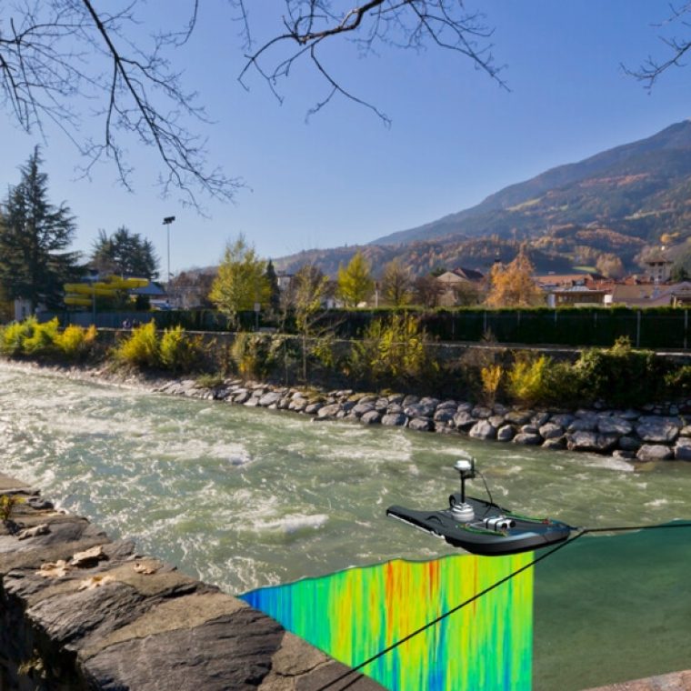
- Graphical Representation: The data collected is usually presented in a graphical format, showing a side view of the land’s profile. This visual representation helps engineers and planners easily grasp the land’s features, making it simpler to devise construction and design strategies.
In essence, a cross-section survey is an invaluable tool for anyone looking to develop land or ensure their project aligns with the natural landscape. At GEO Static, we provide detailed cross-section surveys to equip you with the information you need to move forward confidently.
Our Cross-Section Survey Services
At GEO Static, we’re proud to offer a complete suite of cross-section survey services designed to meet your specific needs. Here’s what we bring to the table:
- Land Surveying and Elevation Mapping: We measure the terrain accurately to create precise elevation profiles. This information is crucial for your construction and development projects, helping you understand the lay of the land.
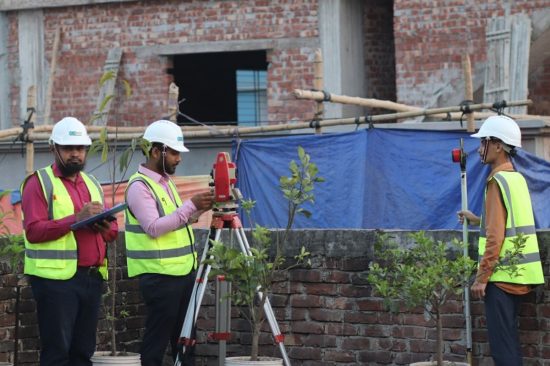
- Advanced Technology: We leverage state-of-the-art tools like laser scanning and Total Stations. This ensures that every measurement we take is spot on, giving you the reliable data you need for your project.
- Customisation Options: Whether you’re tackling a small residential build or a large-scale development, our services are flexible and can be tailored to fit your project requirements. We understand that every project is unique, and we’re here to ensure you get exactly what you need.
Let us help you see your land like never before! Reach out today to discover how our cross-section survey services can make a difference for your project.

Why Choose GEO Static for Cross-Section Survey?
When it comes to cross-section surveys, you want a partner who understands your project needs. Here’s why GEO Static is the ideal choice for your surveying requirements:
- Expertise Across Industries: Our skilled team has extensive experience with cross-section surveys in diverse fields, including construction and environmental assessments. We’re equipped to handle the unique challenges each project presents.
- State-of-the-art technology: We use cutting-edge surveying equipment to ensure accuracy and reliability in every survey. This technology allows us to provide data you can trust for your project’s success.
- Affordable Solutions: We believe in delivering quality services at competitive rates. Our pricing is designed to accommodate various budgets, ensuring you get the best value without compromising on service.
- Client-Focused Service: Your project is important to us. We take the time to listen to your specific needs and adapt our services accordingly. Whether it’s a small plot or a large development, we approach each project with dedication and attention to detail.
- Proven Results: Our satisfied clients consistently highlight how our cross-section surveys have improved their project outcomes. Join the ranks of our happy customers who have benefitted from our expertise!
Ready to enhance your project with accurate cross-section surveys? Contact GEO Static today, and let’s discuss how we can support your goals!
Getting Started with GEO Static for Cross-Section Surveys
If you need accurate and reliable data for your project’s land profiles, Geo Static’s Cross Section Surveys are designed to provide the insight you need. Our team specialises in creating precise cross-sectional data, perfect for evaluating elevation changes and assisting with design and construction planning.
From detailed project quotes to clarifying any questions you might have, we’re here to ensure you get the data you need to move forward. Our expert team is always ready to offer guidance, ensuring your project’s success from start to finish.
To get in touch, call us at +880 1602060802, email us at info@geostaticbd.com, or fill out our easy online form. We’re always happy to help and look forward to assisting you with your Cross Section Survey needs.
The Geo Static Cross-Section Survey Process
Our process for cross-section surveys is designed to be simple and efficient, ensuring a smooth experience for you every step of the way:
- Consultation
We start by discussing your project details and understanding your requirements. After that, we provide a clear and transparent quote.
- On-Site Survey
Our skilled team arrives at your location with the latest surveying tools. We quickly set up and began the data collection process, working efficiently to avoid delays.
- Data Analysis
As we gather data, it’s processed in real-time. This allows us to adjust as needed, ensuring the accuracy of our survey.
- Delivery
Once the survey is complete, we compile all the data into a detailed, easy-to-read report. This includes maps and any critical information you need.
With our streamlined process, you can trust that your cross-section survey will be completed efficiently and accurately, giving you the insights you need to move forward with your project. Contact GEO Static today to get started!
FAQs
Q: What is the purpose of a cross-section survey?
A: A cross-section survey provides detailed information about the land’s features and elevations, essential for planning and construction.
Q: How long does a cross-section survey take?
A: The duration varies based on the project size and complexity, but most surveys can be completed within a few days.
Q: What technology is used in cross-section surveys?
A: We use advanced tools such as GPS, laser scanning, and Total Stations to ensure precision and accuracy in our surveys.
Our Process
Four Steps to Get Our Services

Make Appointment

We Check The Location
Start Land Survey

