
Surveying and mapping have always been vital. Now, with 3D laser scanning, professionals can work faster and more accurately. This technology captures detailed data quickly. It creates precise maps and models. The benefits are clear. Easier data collection. Better results. And more efficient workflows.
This blog will explore these new opportunities. How can 3D laser scanning improve your work? Let’s find out.
Introduction To 3d Laser Scanning
Surveying and mapping have seen significant advancements in recent years. One of the most notable technologies is 3D laser scanning. This method offers new opportunities for professionals in the field.
3D laser scanning provides accurate and detailed data quickly. It has revolutionized how we capture and analyze spatial information.
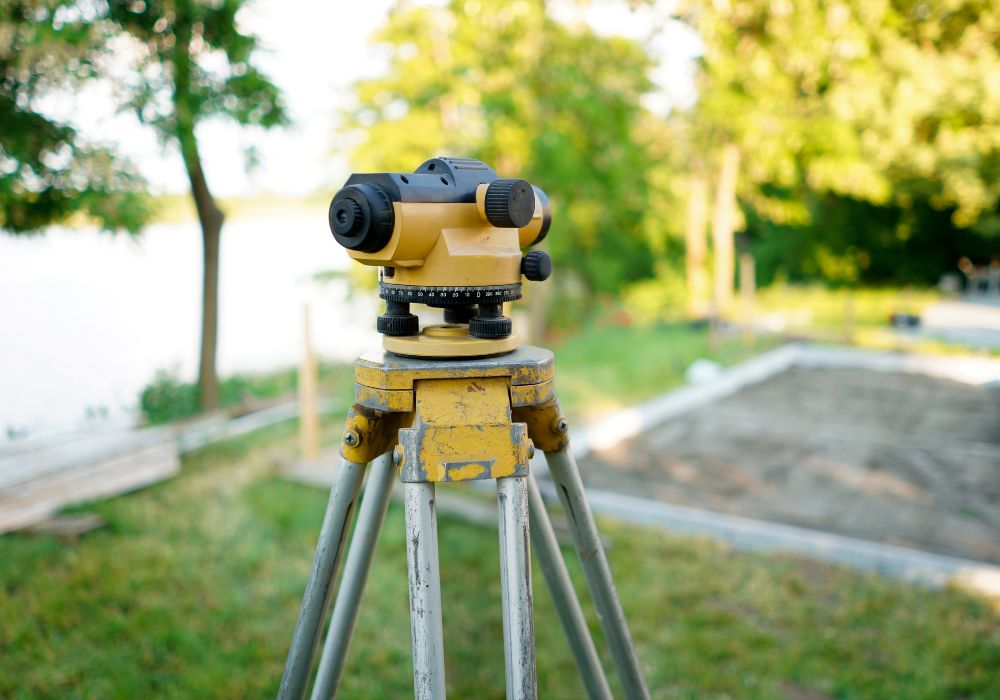
What Is 3d Laser Scanning?
3D laser scanning uses laser light to measure distances. The scanner emits a laser beam that reflects off objects. It then captures the reflected light to measure the distance. This process creates a precise, digital 3D model.
These models are used in various industries. They are especially useful in surveying, mapping, and construction. The data collected is highly accurate and detailed. This ensures better project planning and execution.
Historical Background
3D laser scanning technology started in the 1960s. Early devices were large and expensive. They were mainly used in industrial applications. Over time, the technology improved and became more accessible.
In the 1990s, portable 3D laser scanners were developed. This made the technology more practical for various fields. Today, 3D laser scanning is widely used in many industries.
Its applications range from archaeology to urban planning. The technology continues to evolve, offering new possibilities for professionals.
| Year | Development |
| 1960s | Early development of 3D laser scanning |
| 1990s | Introduction of portable 3D laser scanners |
| Present | Wide usage in multiple industries |
Technological Advancements
The world of 3D laser scanning is evolving fast. Surveying and mapping professionals are experiencing many changes. These advancements bring new opportunities for the industry. Let’s explore some of the modern developments and key innovations shaping this field.
Modern Developments
Recent years have seen significant progress in 3D laser scanning. One major development is the increased accuracy of scanners. These devices now capture details with high precision. This level of detail was not possible before.
Another development is the portability of scanners. Modern devices are compact and lightweight. Professionals can easily carry them to different sites. This makes the scanning process more efficient.
Software advancements also play a crucial role. New software solutions offer better data processing capabilities. They allow professionals to analyze and interpret data quickly. This speeds up the entire surveying and mapping process.
Key Innovations
One key innovation is the integration of 3D laser scanning with drones. Drones equipped with laser scanners can cover large areas quickly. This technology is useful for mapping difficult-to-reach locations.
Another innovation is the use of mobile mapping systems. These systems combine 3D laser scanning with GPS technology. They provide accurate data while moving. This is ideal for surveying roads and large infrastructure projects.
Artificial intelligence (AI) is also making its mark. AI algorithms enhance the data collected by 3D laser scanners. They help in identifying patterns and anomalies. This leads to better decision-making and planning.
These technological advancements are transforming the surveying and mapping industry. Professionals now have access to powerful tools and technologies. This opens up new possibilities for their work.
Applications In Surveying
3D laser scanning is transforming the field of surveying. It provides accurate, detailed data quickly. Surveying professionals use this technology in diverse applications. Let’s explore how 3D laser scanning is applied in surveying.
Construction Projects
3D laser scanning is valuable in construction projects. It captures precise measurements of sites. Surveyors use this data to create accurate models. These models help in planning and designing buildings. They ensure that structures fit well within the site. Laser scanning also tracks construction progress. It compares the built structure with design plans. This helps identify any deviations early. It saves time and reduces costly errors.
Infrastructure Management
Infrastructure management benefits from 3D laser scanning, too. Bridges, roads, and tunnels need regular monitoring. Laser scanning provides detailed images of these structures. It helps detect issues like cracks or deformations. Early detection allows for timely repairs. This extends the lifespan of the infrastructure. Surveyors can also create accurate as-built records. These records are essential for maintenance and future upgrades.
Benefits For Mapping Professionals
3D laser scanning offers many benefits for mapping professionals. This technology brings new levels of accuracy, efficiency, and cost-effectiveness. These benefits are essential for successful surveying and mapping projects.
Accuracy And Precision
3D laser scanning ensures high accuracy and precision. Traditional methods often leave room for errors. With 3D laser scanning, the chances of errors are great. This technology captures detailed measurements with pinpoint accuracy. Mapping professionals can trust the data they collect.
Laser scanners capture millions of data points per second. This allows for very detailed and precise maps. No detail is too small or too complex to be missed. This level of detail is crucial for projects that require exact measurements.
Time And Cost Efficiency
3D laser scanning saves both time and money. Traditional surveying methods are time-consuming and labor-intensive. 3D laser scanning speeds up the process significantly.
- Faster data collection
- Reduced field time
- Lower labor costs
Mapping professionals can complete projects faster. This leads to cost savings and increased productivity. The equipment is also easy to use, requiring less staff training.
Projects that once took weeks can now be done in days. This efficiency allows mapping professionals to take on more projects. More projects mean more revenue opportunities.
Challenges And Limitations
3D laser scanning faces challenges like high equipment costs and the need for skilled operators. Data processing can also be time-consuming.
3D laser scanning offers many benefits to surveying and mapping professionals. Yet, it comes with its set of challenges and limitations. Understanding these hurdles helps in making informed decisions.
Technical Barriers
3D laser scanning demands skilled technicians. Operating the equipment and interpreting the data is not easy. Users must be trained and experienced. Without the right skills, errors can occur. This can lead to inaccurate results. Moreover, the technology itself may have limitations. For example, scanning in harsh weather conditions can be difficult. Dust, rain, and extreme temperatures can affect the accuracy of the scans. Another issue is the range of the laser. Over long distances, the quality of the scan might reduce.
Cost Implications
3D laser scanners are expensive. The initial investment is high. This includes the cost of the equipment and the software. Additionally, maintaining the scanners can be costly. Repairs and updates can add to the expenses. Smaller firms might find it hard to afford these costs. Even large companies need to consider the return on investment. Training staff also involves costs. Sending employees to learn the technology adds to the financial burden. These cost implications can be a significant barrier for many businesses. “`
Case Studies
3D Laser Scanning technology has brought new opportunities for surveying and mapping professionals. By examining real-world examples, we can understand the impact of this technology. In this section, we will explore case studies that highlight successful implementations and lessons learned.
Successful Implementations
Many companies have adopted 3D Laser Scanning to improve their surveying processes. For instance, a construction firm used 3D scans to create accurate site models. This led to better project planning and reduced errors. Another example is a heritage site restoration project. Scanners captured the intricate details of ancient structures. This data helped in precise restorations, preserving historical integrity.
In urban planning, municipalities have used 3D scanning to map city landscapes. These scans provide a clear view of existing infrastructure. Planners can then make informed decisions for future developments. Utility companies also benefit from this technology. Scans of underground pipelines help in maintenance and prevent costly mistakes.
Lessons Learned
While 3D Laser Scanning offers many benefits, there are lessons to consider. One challenge is the initial cost of equipment. Organizations must weigh this against the long-term advantages. Another lesson is the need for skilled operators. Proper training ensures accurate data collection and interpretation.
Data storage and management also pose challenges. Large scanned files require adequate storage solutions. Efficient data handling practices are crucial. Additionally, integrating 3D scans with existing systems can be complex. Companies should plan for compatibility issues and potential software upgrades.
Finally, continuous learning is essential. As technology evolves, staying updated with new advancements is key. This ensures optimal use of 3D Laser Scanning in various projects.
Future Trends
The field of 3D laser scanning is evolving rapidly. Surveying and mapping professionals now have access to advanced tools and technologies. These advancements open up new opportunities. Let’s explore the future trends shaping this industry.
Emerging Technologies
New technologies are emerging in the 3D laser scanning industry. These include:
- Enhanced LIDAR systems
- Portable scanning devices
- Cloud-based data processing
Enhanced LIDAR systems provide higher accuracy. They can capture detailed data faster. Portable scanning devices offer flexibility. Professionals can carry them to remote locations. Cloud-based data processing speeds up workflow. It allows for real-time collaboration.
Potential Market Growth
The market for 3D laser scanning is expanding. Several factors contribute to this growth:
| Factor | Impact |
| Infrastructure Development | Increases demand for precise mapping |
| Urban Planning | Requires detailed 3D models |
| Environmental Monitoring | Needs accurate topographic data |
Infrastructure development increases the demand for precise mapping. Urban planning requires detailed 3D models. Environmental monitoring needs accurate topographic data. These factors drive market growth.
As a result, 3D laser scanning is becoming indispensable. Surveying and mapping professionals must stay updated. They need to embrace these future trends to stay competitive.
Frequently Asked Questions
Q: What Is 3d Laser Scanning?
A: 3D laser scanning is a technology that captures precise measurements of objects and environments. It uses laser light to create detailed 3D models. This technology helps surveying and mapping professionals work more efficiently.
Q: How Does 3d Laser Scanning Work?
A: 3D laser scanning works by emitting laser beams that measure distances to surfaces. These measurements create a point cloud. The point cloud data is then processed into a detailed 3D model. This model can be used for various applications.
Q: Why Is 3d Laser Scanning Important?
A: 3D laser scanning is important because it provides accurate and detailed data. It improves efficiency and reduces errors in surveying and mapping. This technology also allows for better planning and decision-making.
Q: What Are The Benefits Of 3d Laser Scanning?
A: The benefits of 3D laser scanning include higher accuracy, faster data collection, and detailed 3D models. It also reduces the need for manual measurements. This technology helps professionals save time and resources.
Conclusion
3D laser scanning opens new doors for surveying and mapping professionals. It offers precise data and faster results. This technology enhances accuracy in mapping projects. Surveyors can now tackle complex tasks with ease. The adoption of 3D scanning tools is growing rapidly.
Professionals who embrace this tech stay ahead. The future of surveying looks bright with 3D laser scanning. It’s time to explore these new opportunities. Stay updated and continue learning. Your career will benefit greatly.