
Construction and land development projects rely on skilled professionals working together. One of the most crucial partnerships is between land surveyors and engineers. While their roles differ, their collaboration ensures projects are built on accurate data and solid planning.
Surveyors measure land, defining boundaries and assessing site conditions. Engineers use this data to design safe, functional structures that fit the landscape and meet legal requirements.
Without precise surveys, engineers risk flawed designs. Without engineering expertise, survey data alone wouldn’t bring projects to life. Let’s explore how Land Surveyors and Engineers work together, the tools they use, and why their partnership is vital for project success.
The Roles of Land Surveyors and Engineers
Land surveyors and engineers play distinct but interconnected roles in construction and development. Their expertise ensures that every project starts with accurate data and ends with a well-executed design.
Surveyors are responsible for measuring and mapping land. They define property boundaries, assess topographical features, and gather critical data used for construction, legal documentation, and land development. Their work helps prevent boundary disputes and ensures that structures are placed correctly on stable ground. Read more about the role of surveyors in construction.
Engineers, on the other hand, focus on designing and overseeing the construction of buildings, roads, bridges, and other infrastructure. They ensure that projects are safe, functional, and compliant with regulations. Engineers rely on the data provided by surveyors to make informed decisions about land use, structural integrity, and environmental impact. Discover more about engineering in construction.
Both professions require precision and a thorough understanding of industry regulations. Without accurate land data from surveyors, engineers wouldn’t have the foundation needed to create reliable designs. Likewise, without engineering expertise, survey data alone wouldn’t be enough to bring a project to completion.
The Collaborative Process: How They Work Together
The collaboration between land surveyors and engineers is a step-by-step process that ensures every project is built on accurate data and completed according to plan. Their partnership starts long before construction begins and continues throughout the life of the project. Here’s a breakdown of how they work together at each stage:
#1. Pre-Construction Phase
Before construction even begins, the role of the surveyor is crucial. Surveyors assess the land, carefully marking out the property boundaries and mapping the terrain. They gather essential data regarding the land’s features, including elevation, soil types, and potential hazards.
This survey data forms the foundation for any construction project. Engineers rely on this information to decide where and how to build. Without accurate measurements from the surveyor, engineers would lack the critical data needed to make informed decisions.
#2. Design and Planning Phase
With survey data in hand, engineers move on to the design phase. They use the information provided by the surveyor – such as elevation maps, GPS coordinates, and soil reports – to refine their plans and ensure the structure will be stable and fit well with the landscape.
Surveyors and engineers often communicate throughout this phase to adjust the design based on actual site conditions. If unexpected issues arise, such as irregular land features or unstable soil, they can work together to make necessary adjustments before construction begins.
This phase sets the direction for the entire project, and accurate data is critical for achieving a safe, functional design.
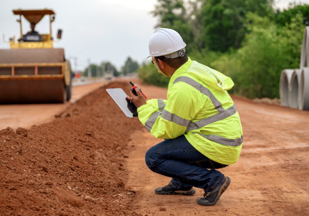
#3. Construction and Execution Phase
Once construction begins, the surveyor’s role doesn’t end. It becomes even more important. Surveyors mark out precise locations for foundations, roads, and other key structures based on the engineer’s plans. They return to the site periodically to ensure the construction aligns with the approved design.
Even a slight misalignment can lead to problems later on, so regular checks are essential. Engineers oversee the construction process, making sure the work is progressing as planned.
If adjustments need to be made – for example, due to unforeseen conditions – engineers and surveyors collaborate to make the necessary changes while keeping the project on track.
#4. Post-Construction and Final Verification
Once construction is complete, the final phase involves verification. Surveyors conduct a thorough check to ensure that everything has been built according to the original plans and complies with legal and regulatory requirements.
They measure and verify the location of the completed structures to confirm there are no discrepancies. Engineers then conduct safety assessments to ensure the integrity of the building or infrastructure. Only when all conditions are met and the design is fully realised can the project be officially approved and handed over.
Tools and Technologies Surveyors and Engineers Used Together
Surveyors and engineers rely on cutting-edge tools and technologies to ensure accuracy, efficiency, and precision in their work. These tools help streamline processes, improve data collection, and aid in creating detailed designs and plans.
- GPS and GNSS Systems: Global Positioning System (GPS) and Global Navigation Satellite Systems (GNSS) provide highly accurate location data, helping surveyors to establish precise boundaries and measure land with pinpoint accuracy.
- LiDAR (Light Detection and Ranging): LiDAR technology uses laser pulses to create 3D maps of the landscape. It can measure distances with extreme precision and produce highly detailed topographical data, which is invaluable for engineers when designing structures.
- Drones: Drones are becoming increasingly popular in land surveying. They can capture high-resolution aerial images and survey vast areas in a fraction of the time it would take a traditional surveyor. Drones help surveyors collect data quickly and cost-effectively, especially in areas that are difficult to access on foot.
- Total Stations: Total stations combine an electronic theodolite for measuring angles with an electronic distance measuring device (EDM). This tool provides highly accurate data on angles and distances and is widely used for topographical surveys, boundary surveys, and construction staking.
- CAD (Computer-Aided Design) Software: Engineers use CAD software to create detailed and accurate blueprints and designs. It allows for precise planning and visualisation of structures, from buildings to bridges, roads, and more. CAD software integrates data from surveyors and enables engineers to model and optimise the design for structural integrity, sustainability, and cost-efficiency.
- GIS (Geographic Information Systems): Geographic Information Systems (GIS) store and analyse geographical data, allowing both surveyors and engineers to make informed decisions. GIS helps engineers understand land features, zoning regulations, environmental concerns, and other factors that could impact a project.
Importance of Accuracy and Compliance in Projects
Precision is vital in construction. Even small measurement errors can lead to major issues, such as legal disputes, structural failures, or unexpected costs. Surveyors ensure property boundaries are accurate, while engineers focus on the structural integrity of the design.
Compliance with local regulations is also crucial. Both surveyors and engineers must follow government guidelines to avoid legal complications. For example, in Bangladesh, adherence to the Bangladesh National Building Code (BNBC) ensures safety and regulatory compliance.
Mistakes in surveying or engineering can result in delays or even project shutdowns, making accuracy and compliance top priorities for successful project completion.
Why Their Partnership Is Essential for Successful Projects
The partnership between surveyors and engineers is crucial for delivering successful projects, ensuring they are completed with precision and efficiency.
- Minimises Errors – Engineers rely on accurate survey data to avoid costly design mistakes and ensure the structure fits the land properly.
- Reduces Costs – Proper planning based on detailed survey data helps prevent unforeseen expenses, saving time and money during construction.
- Ensures Legal Compliance – Accurate land surveying helps define property boundaries clearly, preventing disputes and ensuring the project complies with local regulations.
- Supports Timely Delivery – Close collaboration between surveyors and engineers ensures projects stay on schedule by addressing issues early and maintaining coordination.
Conclusion
Land surveyors and engineers are essential partners in any construction or development project. Surveyors provide the critical data, while engineers bring that information to life with their designs. Without this collaboration, projects risk costly mistakes, delays, and legal issues.
Together, they create a solid foundation for successful and well-executed projects. By combining their expertise, they ensure that every structure is not only functional but also safe and compliant with regulations. Their teamwork is what truly makes a project a success.